UPDATED 12:34 PM – Tuesday, February 17
The National Weather Service in Grand Forks, North Dakota, has issued a Winter Storm Watch for Northern North Dakota and Northern Minnesota from Tuesday night through Wednesday evening.
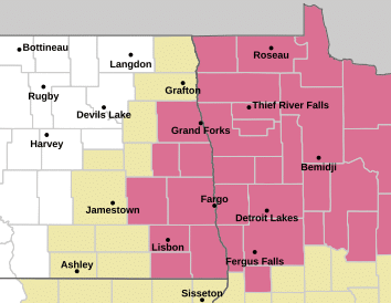
The watch includes portions of northwest and north central Minnesota and eastern North Dakota, including the following Minnesota counties: Polk, Norman, Kittson, Roseau, Lake Of The Woods, Marshall, Beltrami, Pennington, Red Lake, Clearwater, Mahnomen, and Hubbard. The following North Dakota counties: Towner, Cavalier, Pembina, Benson, Ramsey, Walsh, Eddy, Nelson, Grand Forks, Griggs, Steele, and Traill.
The watch includes the cities of Crookston, Warren, East Grand Forks, Grand Forks, Thief River Falls, Bemidji, Ada, Fosston, Hallock, Red Lake Falls, Bagley, Cando, Leeds, Devils Lake, Langdon, Baudette, Roseau, Hillsboro, Finley, Cavalier, Lankin, Drayton, Halstad, Mahnomen, Lake Itasca, Red Lake, Newfolden, Middle River, Mayville, Cooperstown, Michigan, Park Rapids, New Rockford, and Grafton,
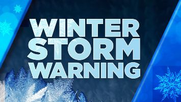
…WINTER STORM WARNING REMAINS IN EFFECT FROM 6 PM THIS EVENING TO MIDNIGHT CST WEDNESDAY NIGHT…
* WHAT…Heavy mixed precipitation and areas of blowing snow expected. Total snow accumulations between 5 and 10 inches with locally higher amounts. Ice accumulations of a glaze. Winds gusting as high as 40 mph.
* WHERE…Portions of north central and northwest Minnesota and northeast North Dakota.
* WHEN…From 6 PM this evening to midnight CST Wednesday Night.
* IMPACTS…Travel will be very difficult. Falling and blowing snow will lead to areas of quick and sudden reductions to visibility, making travel difficult, especially in rural areas that are prone to blowing snow. The hazardous conditions will impact the Wednesday morning and evening commutes.
PRECAUTIONARY/PREPAREDNESS ACTIONS… Monitor KROX Radio and KROXAM.com for the latest forecasts for updates on this situation.