Skip to content
Customize Consent Preferences

We use cookies to help you navigate efficiently and perform certain functions. You will find detailed information about all cookies under each consent category below.

The cookies that are categorized as "Necessary" are stored on your browser as they are essential for enabling the basic functionalities of the site. ... 

Always Active

Necessary cookies are required to enable the basic features of this site, such as providing secure log-in or adjusting your consent preferences. These cookies do not store any personally identifiable data.

No cookies to display.

Functional cookies help perform certain functionalities like sharing the content of the website on social media platforms, collecting feedback, and other third-party features.

No cookies to display.

Analytical cookies are used to understand how visitors interact with the website. These cookies help provide information on metrics such as the number of visitors, bounce rate, traffic source, etc.

No cookies to display.

Performance cookies are used to understand and analyze the key performance indexes of the website which helps in delivering a better user experience for the visitors.

No cookies to display.

Advertisement cookies are used to provide visitors with customized advertisements based on the pages you visited previously and to analyze the effectiveness of the ad campaigns.

No cookies to display.

ADVERTISE WITH US | EMAIL: KROX@RRV.NET

MnDOT TO CONDUCT AERIAL PHOTOGRAPHY ON HIGHWAYS 2, 32, AND 71 IN NORTHWEST MINNESOTA

The Minnesota Department of Transportation is asking residents not to disturb aerial photography targets as crews begin aerial mapping in northwestern Minnesota. Landowners in the area that will have targets placed on or near their property will be contacted directly. Weather permitting, work will begin mid-October. The mapping will take place in the following locations:

  • Highway 2- Business route in East Grand Forks
  • Highway 32 – from Highway 2 to Sand Hill Road
  • Highway 71 – North of Bemidji from East Movil Lake Road to Turtle River

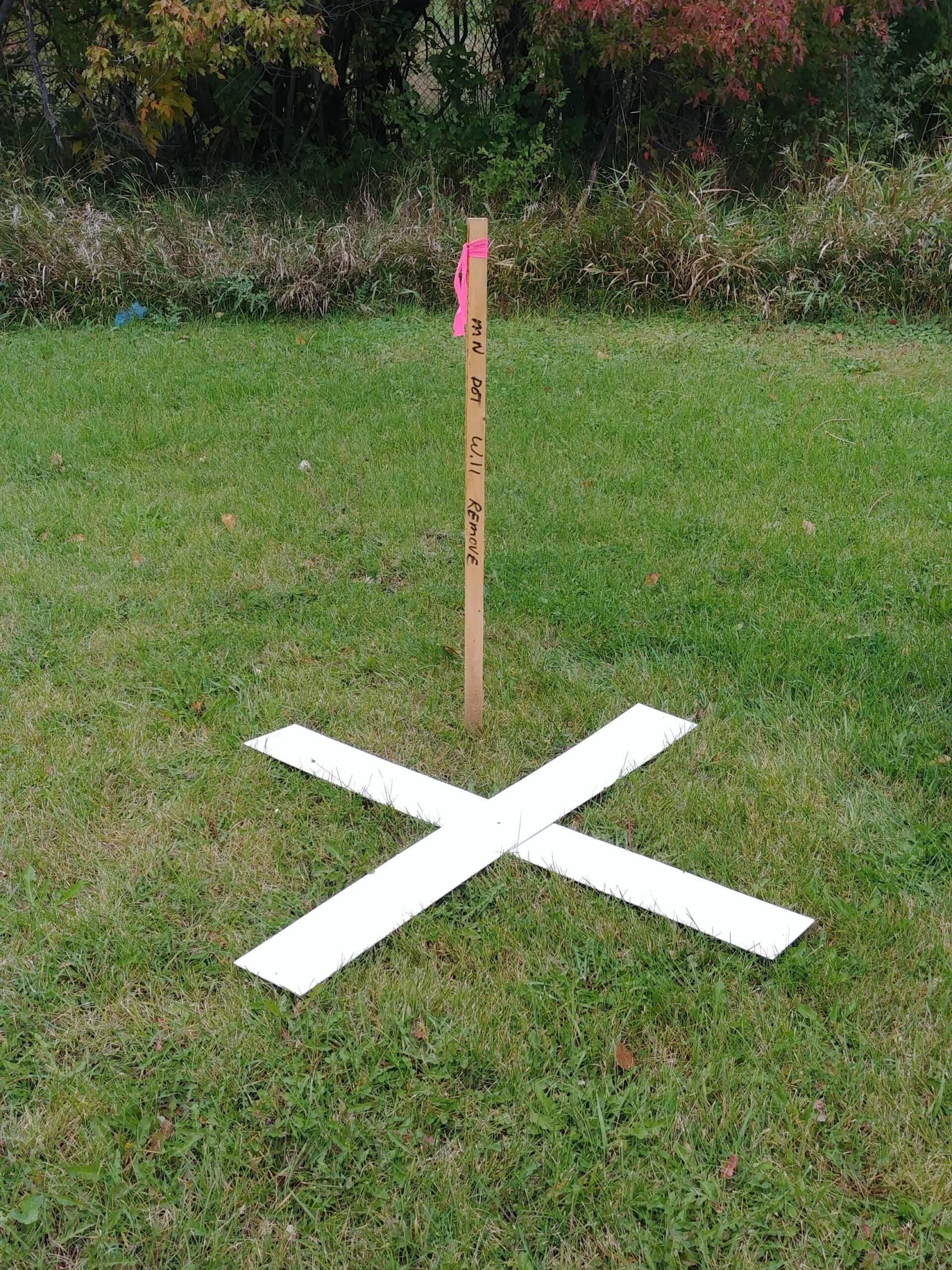
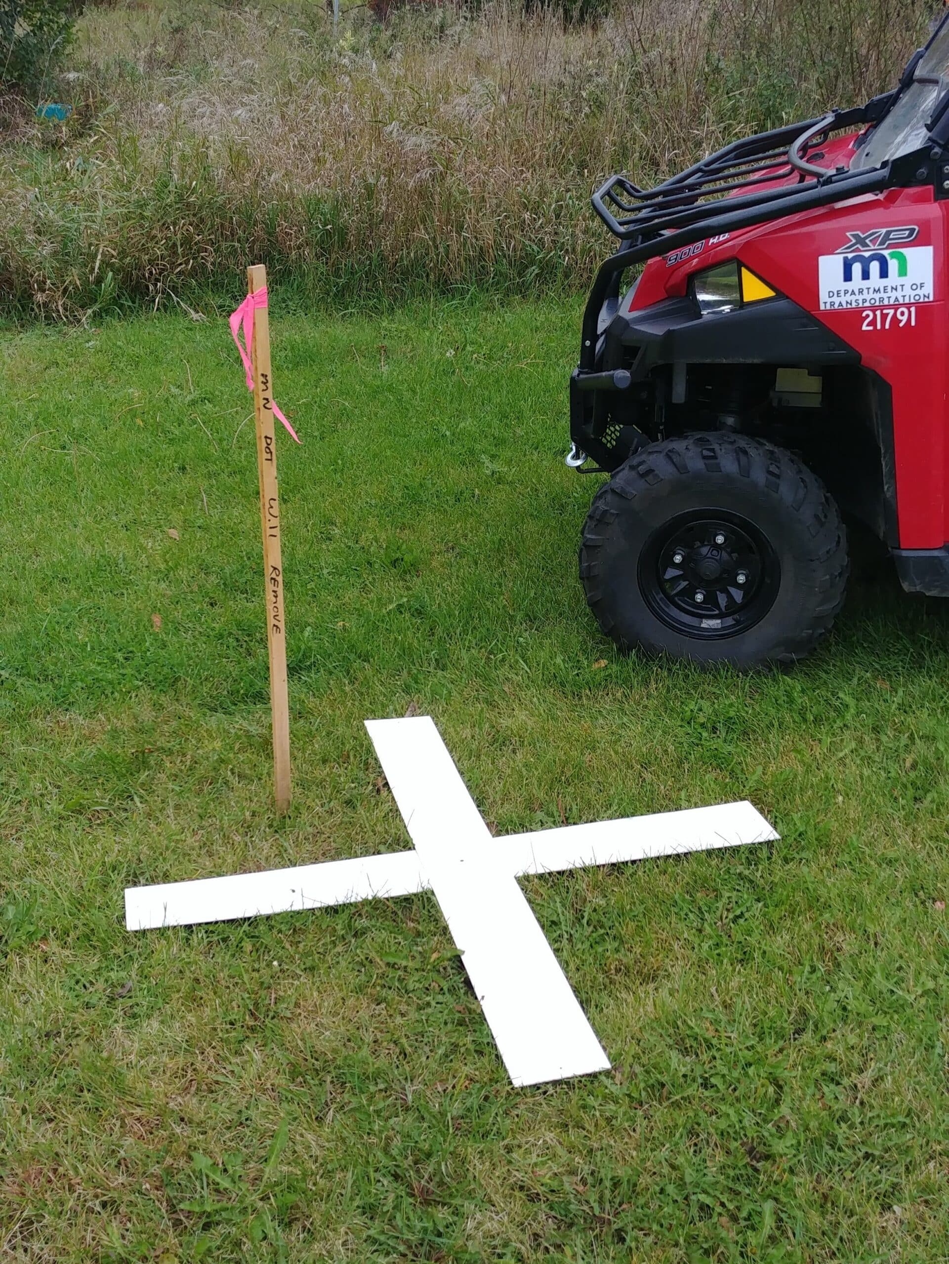
The aerial survey process relies on clear observations and must be conducted after the leaves fall and before it snows. To begin the process, crews place an “X” on the ground as a reference point for the aerial photographer.

Aerial mapping is used to create a record of existing infrastructure and landscape along MnDOT’s right of way for transportation planning and highway design. In order to obtain accurate aerial mapping, MnDOT crews paint large white “X” targets on paved surfaces and place plastic or fabric “X” targets on unpaved surfaces.

A survey crew then records the coordinate position and elevation of the temporary targets for the aerial photography company. The plastic and fabric targets are temporary and will be removed when the photography is completed.

MnDOT requests that landowners not remove or disturb the targets, if possible, until the photography is completed. If a target must be moved, please contact the District 2 survey office at 218-755-6509 or by email at drew.mistic@state.mn.us

Share:
Tags: , , , , , ,