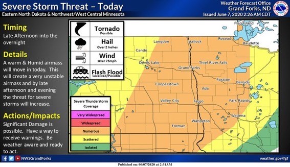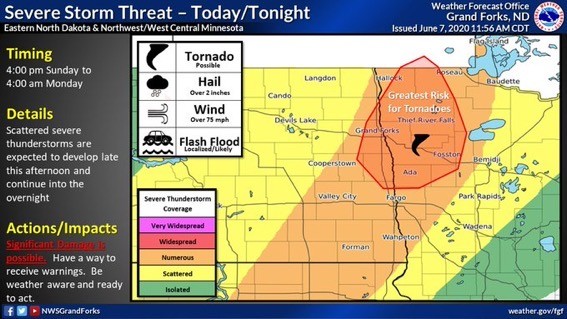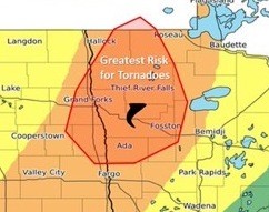
The National Weather Service in Grand Forks is warning people in northwest and west-central Minnesota and eastern North Dakota of possible severe thunderstorms and maybe even tornados in the KROX listening area Sunday afternoon.
Severe thunderstorms are expected with hail over two inches in diameter, wind gusts over 75 mph, tornados are possible, and heavy rainfall that could lead to localized flash flooding. The storms are expected in northwest Minnesota generally after 4:00 p.m. and continue through the evening and into the overnight hours. Stay tuned to KROX Radio (1260AM/105.7FM), online, and on social media. We will keep you updated as the afternoon progresses.
Reminders on the difference between a watch and a warning –
Reminders on the difference between a watch and a warning –
Severe Thunderstorm Watch – Is issued when conditions are favorable or severe thunderstorms to develop. When a watch is issued, it is time to prepare and stay weather aware.
Severe Thunderstorm Warning (Severe Thunderstorms are officially defined as storms that are capable of producing hail, straight-line winds. Some thunderstorms have produced wind gusts in excess of 100 mph and have created widespread wind damage similar to that of a tornado) – Is issued when a thunderstorm poses a threat to life or property. When a warning is issued, it is the time to act.
When a warning is issued – Go indoors and stay away from windows. If you are caught outside, do not seek shelter underneath a tree – they are prone to lightning strikes. A hard-topped vehicle may offer some protection as a last resort. Do not touch the sides of the vehicle.