The Tuesday topic for Severe Weather Awareness Week is Severe Storms, Lightning, and Hail. Warm, humid conditions are favorable to storm development and storms typically are small producing heavy rain and wind over a relatively small area for a brief period of time explains Crookston Firefighter Justin Johnson. “They are relatively small, about 15 miles in diameter and will last about 30 minutes,” said Johnson. “Severe thunderstorms can produce large hail and heavy winds of at least 58 mph. Some wind gusts can exceed 100 mph and produce tornado-like damage. About 10 percent of storms are severe and may occur in clusters or lines.”
The best place to in a storm is a basement with water pipes and electrical explains Johnson. “The safest place to be during a thunderstorm is in the basement of any normal building away from windows,” said Johnson. “Most hardtop cars are safe from the lightning. Convertibles, motorcycles, bicycles and fiberglass vehicles offer no protection from lightning. Avoid contact with interior metal during a storm.”
It’s important to remember if you can hear thunder lightning can strike you and the only safe place is inside. “No place outside is safe when thunderstorms are in the area,” said Johnson. “If you hear thunder, lightning is close enough to strike you. When you hear thunder, immediately move to a safe shelter, a building or closed metal top vehicle with windows up. And stay in a safe shelter for at least 30 minutes after you hear the last sound of thunder.”
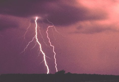
Getting struck by lightning is more common than you might think with 240,000 people struck each year. “Lightning bolts can be over five miles in length,” said Johnson. “Lightning can strike up to 15 miles away from the center of the storm. National Weather Service data says the chance of being struck by lightning once in your lifetime is 1 in 12,000.”
Hail will also accompany thunderstorms and the larger the hail the faster it falls making it more dangerous. “Hail can range from pea size, which is most common, to baseball size or bigger,” said Johnson. “Large hailstones fall faster than 100 mph and can severely injure or kill people.”
Minnesota’s statewide tornado drill will take place on Thursday. Outdoor warning sirens and NOAA Weather Radios across the state will be sounded at 1:45 p.m. and 6:45 p.m.
Tags: