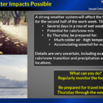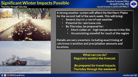
The National Weather Service in Grand Forks has issued an update on the strong weather system that is expected to bring a prolonged period of colder and wet weather to the northern plains this week.
The announcement includes the following points:
- Low confidence in the details regarding precipitation – Exact timing of rain/snow transition(s) and precipitation amounts, and locations are very uncertain. However, confidence is increasing in the likelihood of widespread accumulating snowfall, which would cause travel impacts.
- Low confidence in the exact start time, end time, and duration of winter impacts – Winter impacts are most likely to occur at some point on Thursday and Friday but could occur on Wednesday night and Saturday as well.
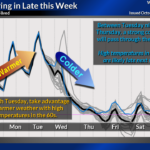
- Higher confidence in temperatures – Temperatures will likely fall to near to below freezing late this week (probably by Thursday).
- A hard freeze is likely to occur by the end of the week.