The National Weather Service in Grand Forks, North Dakota, has moved up the Winter Storm Watch for northwest Minnesota and eastern North Dakota. The watch will start at 6:00 p.m. Monday (December 12) and run through late Wednesday night.
The watch includes the Minnesota cities of Crookston, East Grand Forks, Ada, Twin Valley, Halstad, Moorhead, Hallock, Karlstad, Lancaster, Warren, Stephen, Argyle, Breckenridge. The following North Dakota cities – Cando, Langdon, Cavalier, Walhalla, Drayton, Pembina, Neche, St. Thomas, Fort Totten, Maddock, Leeds, Minnewaukan, Devils Lake, Grafton, Park River, New Rockford, Lakota, Mcville, Aneta, Tolna, Grand Forks, Cooperstown, Finley, Hope, Mayville, Hillsboro, Hatton, Portland, Valley City, Fargo, Lisbon, Enderlin, Gwinner, Milnor, Forman, Rutland, Wahpeton, Edinburg, Adams, and Lankin.
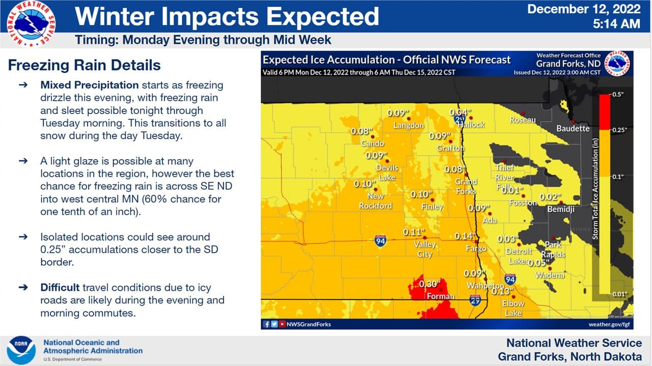
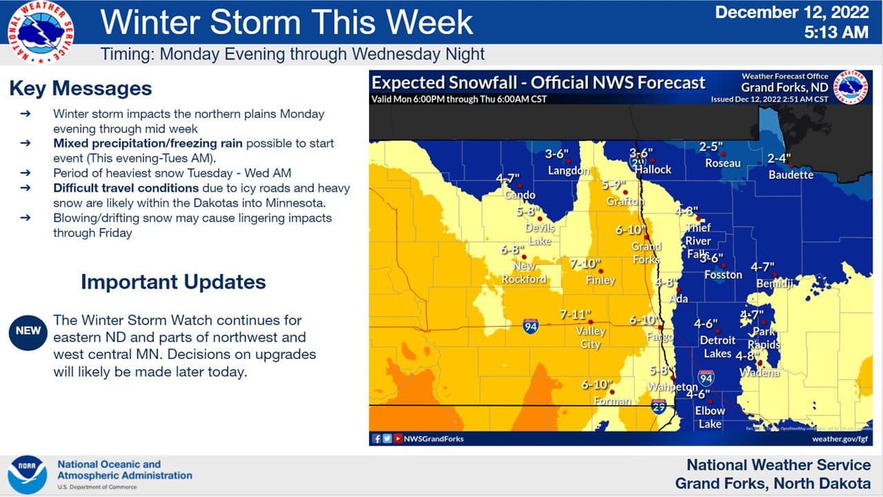
* WHAT…Heavy mixed precipitation possible, then heavy snow. Total snow accumulations of 4 to 10 inches and ice accumulations of up to two tenths of an inch possible. Winds could gust as high as 35 mph.
* WHERE…Portions of northwest and west central Minnesota and northeast and southeast North Dakota.
* WHEN…From this evening through late Wednesday night.
* IMPACTS…Travel could be very difficult. Patchy blowing snow could significantly reduce visibility. The hazardous conditions could impact the morning or evening commute.
* ADDITIONAL INFORMATION…The highest ice accumulations are expected to be in southeastern North Dakota, where up to two tenths of an inch is possible.
Stay tuned to KROX for updated storm information throughout the week.