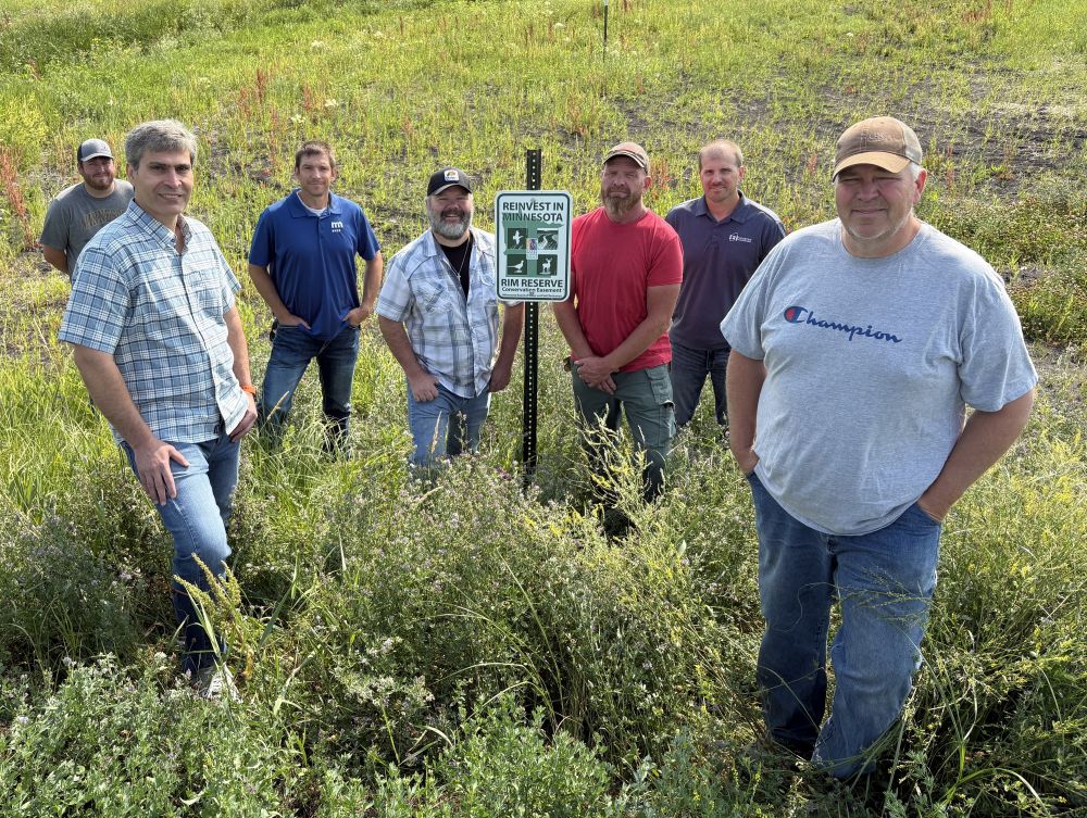
In Marshall County, the solution to farmers’ decades-long drainage and erosion problems along Swift Coulee came with partnerships and funding that transformed the project into a 9-mile-long stream restoration surrounded by 740 acres of permanent wildlife habitat with water quality benefits that extend to the Red River.
“It started as a flood-reduction project to begin with, and then it became apparent that we could help improve water quality with this type of a project and at the same time improve wildlife habitat,” said Marshall County SWCD Manager Darren Carlson, who worked with landowners to fine-tune plans and Reinvest in Minnesota (RIM) options.
The Middle Snake Tamarac Rivers Watershed District (MSTRWD) leads the $12.9 million multi-benefit, multi-partner undertaking, which involves about 100 individuals — landowners, operators and renters; county and watershed district staff and board members; and local, state and federal agency staff.
“This project really highlights the benefits you get when (partners) work together,” said MSTRWD Administrator Mori Maher. “The watershed district was the project lead, but the project required partnership with the soil and water conservation district (staff) working with the landowners and securing the RIM easements. There was also involvement of the county board through the project work team, and the project outlets into one of their county ditch systems.”
The first $4.9 million, 4-mile-long segment was constructed in summer 2025. It involved 18 parcels and 7.5 miles of remeandered coulee surrounded by 247 acres enrolled in permanent easements and seeded into native grasses and wildflowers.
Construction could start as early as 2027 on the next, upstream segment of the Swift Coulee restoration. By late summer 2026, preliminary designs were complete, landowners were getting a look at potential easement boundaries, and the watershed district was seeking additional funding.
The 2025 work drew $2.7 million from a stream restoration and enhancement grant available through the Minnesota Pollution Control Agency; and it applied $250,000 in Watershed-Based Implementation Funding (WBIF) from the Minnesota Board of Water and Soil Resources (BWSR) to project development, engineering and design. The watershed partnership has received three rounds of formula-based WBIF totaling nearly $4.4 million since 2022 to assist with priorities identified in the partnership’s comprehensive watershed management plan, developed through BWSR’s One Watershed, One Plan program.
To make the easement payments more competitive, the MSTRWD contributed additional funds to close the gap between RIM rates and current land values.
For the first time in his 25-year farming career, this season Ken Johnson’s Warrenton Township fields didn’t flood when Swift Coulee spilled out of its banks during the spring melt.
“It was good to finally get something accomplished here after basically my whole farming career at high risk there all the time. If you got even a 1- (or) 2 ½-inch rain, you lost the field or most of the field because the water wouldn’t go (anywhere),” Johnson said.
Between them, he and his father have farmed the land for 40 years. Johnson had tried working with landowners himself, and served on the Swift Coulee Project Work Team for about 25 years. Because the coulee was a Minnesota Department of Natural Resources (DNR) regulated natural waterway, there was little individual landowners could do. And no funding.
The Swift Coulee/Marshall County Ditch #3 Project Team met off and on, but watershed planning began in earnest in 2016 when the work team developed a purpose, need — and 13 alternatives.
Six years ago when Maher joined the MSTRWD, he pursued permits and funding for the preferred channel restoration alternative. He met several times with landowners to fine- tune final plans. And he worked with Tony Nordby of Houston Engineering, who had worked through the 13 design alternatives with the project team.
“When the initial survey was performed as this project developed, you could hardly (see) where the coulee existed on the west side of Highway 75. It was all silted in,” Nordby said.
Previously, MSTRWD engineering technician Tyler Larson said, a 1 ½-inch rain, could flood fields for weeks. The 4-inch rainfall total for June would have destroyed crops in parts of fields adjacent to the coulee. That didn’t happen this year. It was rare to see no signs of crop loss by July, and rare to see little to no standing water in the coulee.
Before construction could begin, permits were required from the U.S. Army Corps of Engineers, the U.S. Environmental Protection Agency, the MPCA, DNR and Minnesota Department of Transportation. The project also required compliance with the Wetland Conservation Act.
Nordby described how that segment of Swift Coulee now functions:
“Once water gets high enough that it could potentially come out of that low meander, we’ve got the floodplain that it can access and stay within the setback levies. We’ve also got the safeguards with the side-water inlet culverts that have flap gates on the downstream side so floodwater can’t back into the adjacent property. Those side-water inlets also act as a mechanism to meter the water off the landscape and into the system.”
The floodplain is designed to contain a 10-year, 24-hour, 3 ½ -inch rainfall. The levies protect adjacent land from more severe flooding.
“The obvious benefit is going to be reduced sedimentation, reduced phosphate-loading downstream. Just the timing of the release of the water is going to reduce the sedimentation of the systems downstream of the coulee. Changes we make here will reduce the sedimentation risk not only on the footprint of this project, (but) on the footprint of the entire drainageway downstream,” said Joe McGregor, MSTRWD board member.
From Swift Coulee, water flows into Marshall County Ditch 3, and then the Snake and Red rivers. The first segment would keep an estimated 4,273 tons of sediment out of the coulee; the entire project, 8,273 tons.
In late July, native grasses and wildflowers were a few inches tall, more visible after a recent mowing. Larson will be responsible for monitoring and maintaining the easements.
“The watershed taking care of that maintenance piece long-term is a huge buy-in for some of the more skeptical landowners initially — (that) there’s going to be somebody else whose job it is to ensure (Swift Coulee) functions … (into) the next generation,” Larson said.
Watershed and SWCD staff expect that seeing how the 4-mile-long restoration functions will make it easier for landowners along the next, 5-mile stretch to decide how they would like to proceed. The two segments together involve 40 parcels and 30 landowners.
A $2.6 million Outdoor Heritage Fund grant awarded to the MSTRWD in 2025 is earmarked for construction. The next phase of work — estimated to cost $4.9 million for construction and about $2.6 million for easements — would also draw from WBIF (and watershed district funds) for engineering. Permanent easement funding would come from the Red River Basin Riparian Habitat Program, a partnership between BWSR and the Red River Watershed Management Board funded by the Outdoor Heritage Fund that employs RIM easements to restore priority riparian habitat corridors.
McGregor explained why the project was a priority for the watershed partnership, which decides where to funnel Watershed-Based Implementation Funding.
“The Swift Coulee over the years has gotten wider and shallower due to sedimentation and backslope erosion. The affected landowners were legally unable to do any maintenance, as it’s a Minnesota public waterway,” McGregor said. “We were able to engineer a solution that provides clean water benefits as well as flood mitigation as well as restoring the drainage to these landowners. It’s really a win-win for everybody involved, both the landowners and the environmental stakeholders.”